Mount Teide Volcano: Height, Geology, and Eruption History
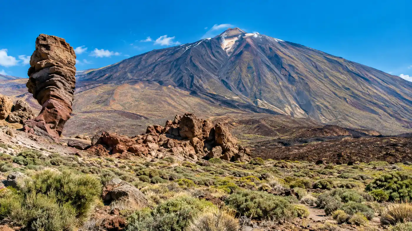
Driving up through the pine forests of Tenerife into the Las Cañadas caldera feels like crossing into another world. The green trees thin out, the air gets cold and thin, and suddenly you stare across miles of twisted black basalt and golden pumice. Towering over everything is the teide volcano, a sharp volcanic cone scraping the Atlantic sky. It dominates the island completely, casting a triangular shadow across the ocean at sunrise and drawing millions of travelers to its slopes every year.
Most visitors know it simply as the massive mountain in the center of Tenerife, but the story beneath your boots is far more dramatic than a pretty backdrop for holiday photos. This mountain is a restless stratovolcano born from cataclysmic landslides, explosive caldera collapses, and centuries of volcanic fury. Understanding how it formed, how tall it stands, and when it last tore open makes standing in its shadow an entirely different experience.
Book your teide national park experience:
How High is Mount Teide? Altitude and Scale
If you look at raw elevation from sea level, the official mount teide height sits at 3,715 meters, or roughly 12,188 feet. That makes Pico del Teide the highest mountain in Tenerife and the tallest peak on Spanish territory. It also ranks as the highest point on any island in the entire Atlantic Ocean. When people ask how high is mount teide in tenerife, the summit figure only tells half the story.
Measured from its true base on the dark ocean floor, the full teide volcano height reaches about 7,500 meters. That is nearly 24,600 feet from seafloor to craggy peak. In terms of sheer volcanic volume, it is the third largest volcano on Earth, trailing only Mauna Loa and Mauna Kea in Hawaii. You are looking at an absolute colossus anchored deep in the oceanic crust.
Up at the top, that elevation hits your lungs fast. The air contains significantly less oxygen than down at the beach in Costa Adeje, and walking even twenty paces on the summit path will leave you winded.
Note: Teide national park altitude sickness is very real above 3,000 meters. If you get a throbbing headache or sudden nausea, stop climbing, drink water, and take the cable car back down immediately instead of trying to push through.
Beside the main peak sits Pico Viejo, its ancient sibling, reaching a respectable 3,135 meters. Together, these two peaks form a jagged double-cone skyline that shapes the weather patterns of the entire Canary archipelago, holding trade wind clouds on the northern slopes while the southern beaches bask in relentless sunshine.
The Volcanic Landscape: Las Cañadas Caldera and Pico Viejo
The surreal teide national park volcanic landscape you see today did not appear overnight. Millions of years ago, several volcanic shields fused together to create an ancestral massif. Over millennia, eruptions piled lava higher and higher until a monstrous proto-volcano stood here, easily rivaling the present peak. Then, roughly 170,000 years ago, that gigantic structure lost its stability and collapsed in a massive landslide that sent cubic miles of rock tumbling north into the ocean basin.
What remained was the Las Cañadas caldera, an elliptical depression measuring roughly 16 by 9 kilometers across. Inside this vast bowl, new magma pushed toward the surface. The modern teide peak and the adjoining Pico Viejo crater grew directly out of the ruins of the older collapsed system, filling the caldera floor with waves of viscous lava and ash fields.
Walking the caldera floor feels like trekking across Mars. You pass jagged fields of badlands lava - locally called malpaís - where sharp basalt tears through soft soles, sitting right next to pale drifts of light pumice and vibrant green phonolite rock towers.
- Roques de García: A dramatic spine of eroded volcanic plugs standing between the caldera floor and the base of the cone, featuring the famous finger-like Roque Cinchado.
- Narices del Teide: A series of blackened explosion vents gouged into the western flank of Pico Viejo that still smell faintly of sulfur on damp mornings.
- Montana Blanca: A rounded shoulder blanketed in beige pumice balls, offering the main walking approach toward the upper refuge.
- Los Gemelos: Twin parasitic cones showing how magma repeatedly found alternative pathways out of the fractured caldera basement.
The colors shift constantly through the afternoon. Yellow sulfur crusts, oxidized iron reds, deep obsidian blacks, and chalky white ashes collide in patterns you will not find anywhere else in Europe.
Mount Teide Eruption History: Is Mount Teide an Active Volcano?
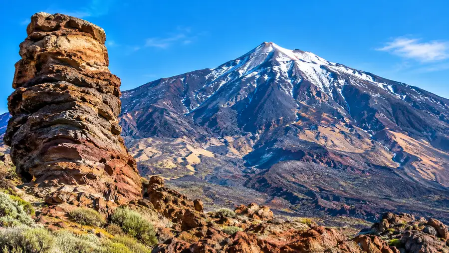
Travelers routinely ask: is mount teide an active volcano? The direct answer is yes. Mount Teide is categorized as active and dormant, meaning it retains an active magma chamber beneath the caldera floor, exhibits degassing at the summit rim, and will erupt again in the geological future. It is not extinct, though its rhythm of activity tends to be measured across centuries rather than months.
The last time the actual summit vent of Pico del Teide erupted was roughly 1,000 years ago, around the year 900 AD. That violent event deposited a thick cap of black obsidian lava known as the Lavas Negras, which covers the upper cone. Since then, eruptions in Tenerife have shifted to flank fissures and parasitic vents across the rift zones.
Christopher Columbus recorded seeing a violent glow from Tenerife as he sailed past the island in August 1492 on his first transatlantic voyage. Geological evidence links his observation to an eruption at Boca Cangrejo on the northwest ridge. Later centuries brought several well-documented historic eruptions that altered the island forever.
| Year | Eruption Vent | Duration | Historical Impact |
|---|---|---|---|
| 1704 - 1705 | Siete Fuentes, Fasnia, Arafo | 3 months | Fissure eruptions along the eastern rift, threatening local inland valleys. |
| 1706 | Montaña Negra (Garachico) | 9 days | Lava streams destroyed the wealthy port town of Garachico, filling its deep harbor. |
| 1798 | Chahorra (Narices del Teide) | 99 days | Flank eruption on Pico Viejo, spewing basalt bombs across the caldera floor. |
| 1909 | Volcán Chinyero | 10 days | The most recent eruption in Tenerife, leaving pristine black cinder fields near Santiago del Teide. |
The 1706 disaster at Garachico was economically devastating. Molten rock swept through the main commercial hub of the island, swallowing sugar warehouses, churches, and the natural deep-water anchorage within days. Miraculously, few people died because the lava crept forward slowly enough for residents to flee up the cliffs.
The 1798 event at Narices del Teide was spectacular, shooting ash clouds thousands of feet into the sky for over three months. Since the 1909 Chinyero vent went quiet, Tenerife has enjoyed over a century of surface peace.
Book your teide national park experience:
Climbing to Pico del Teide: What to Know
Reaching the highest ground on the island is an unforgettable adventure, but it requires advance planning. Most visitors ride the cable car from the base station at 2,356 meters up to La Rambleta at 3,555 meters. From there, the final 160 vertical meters to the crater rim are strictly controlled by park authorities to protect the fragile geology and limit trail congestion.
You cannot simply hike to the top crater on a whim. Securing a Mount Teide summit permit is mandatory for that final stretch of Path No. 10 (Telesforo Bravo), and slots often fill up two or three months in advance during peak seasons.
Pro tip: If permits are sold out on the official national parks website, booking a guided tour that includes reserved summit access or staying overnight at high altitude can sometimes get you on the restricted trail.
If you prefer using your legs instead of riding the cable car, hiking Mount Teide via Montaña Blanca is the classic route. It takes about five to six hours of relentless uphill slogging over loose pumice and jagged basalt. The grade is steep, the air gets noticeably thinner past 2,700 meters, and the wind near the summit can drop temperatures below freezing even in mid-summer.
- Layered clothing: Wear a windproof outer shell, a warm fleece, and long pants, because summit winds frequently drop wind chills below 0 degrees Celsius.
- Footwear: Sturdy hiking boots with thick soles are essential to protect your feet from sharp volcanic slag along the trails.
- Sun protection: UV radiation at 3,700 meters is ferocious; pack high-SPF sunscreen, polarized sunglasses, and a wide-brim hat.
- Water supply: Carry at least 2 liters of water per person, as there are zero water taps or shops once you leave the base station.
Standing on the crater rim makes every drop of sweat worth it. You look down into the sulfurous depression, smelling warm volcanic gases venting from small yellow cracks, with the whole archipelago laid out on the Atlantic horizon.
Volcano Alert Levels and Monitoring Today
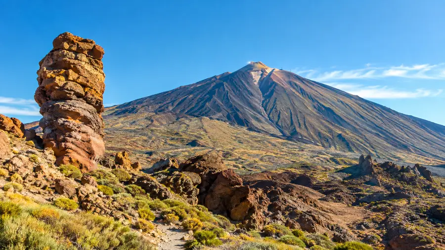
Because millions of tourists and nearly a million residents share this volcanic island, Tenerife volcanic activity is monitored around the clock. The Instituto Geográfico Nacional (IGN) and the Instituto Volcanológico de Canarias (INVOLCAN) maintain a dense network of seismometers, GPS ground-deformation sensors, gas-monitoring stations, and satellite radar tools across the park.
Whenever small seismic swarms occur beneath the caldera, sensational headlines sometimes announce an imminent disaster. The reality on the ground is far calmer. Micro-earthquakes happen regularly beneath dormant volcanic islands as hydrothermal systems shift and deep subterranean gases migrate through existing fracture networks.
The current volcanic alert level for Tenerife sits at green, signifying normal baseline status. Volcanologists agree that any future eruption will be preceded by weeks or months of clear warning signs: sustained swarms of felt earthquakes, measurable ground swelling, and sharp increases in carbon dioxide emissions.
Future volcanic activity is expected to follow the pattern of the last few thousand years. That means a flank fissure eruption producing slow-moving basalt flows rather than a catastrophic explosive blast from the summit crater. The island is thoroughly prepared, with established evacuation plans and monitoring stations that rank among the most sophisticated in the volcanic world.
Frequently Asked Questions about teide volcano
Is Mount Teide active or dormant?
Mount Teide is officially active, currently resting in a dormant state. The last summit eruption occurred around 900 AD, but fumaroles inside the crater continue to release steam and sulfur gases today.
When did a volcano in Tenerife last erupt?
The most recent volcanic eruption on Tenerife occurred in November 1909 at the Chinyero vent, located northwest of the main Teide massif. The eruption lasted 10 days and produced no human casualties.
How high is the summit above sea level?
The summit of Mount Teide reaches an altitude of 3,715 meters (12,188 feet) above sea level, making it the highest mountain in Spain and the tallest peak across the Atlantic islands.
Quick Reference
- Summit elevation: 3,715 meters (12,188 feet)
- Total volcanic height: 7,500 meters from ocean floor
- Last summit eruption: Circa 900 AD
- Most recent island eruption: Volcán Chinyero in 1909
- Current alert status: Green (normal background activity)
Book your teide national park experience:
The Bottom Line
Standing on the edge of the crater rim with sulfur steam swirling around your boots makes you realize how alive Tenerife really is. The island is not just a collection of sunny resort towns and palm trees, it is the weathered summit of a giant oceanic volcano with an extraordinary past. Take the time to wander into the caldera, watch the afternoon light turn the pumice fields from pale cream to deep amber, and respect the raw subterranean heat resting quietly beneath your feet.
Read more about teide national park.